
Wasteland to Wetland
Design on a Natural Periphery & UAS Remote Sensing Methods
Sustainable Architecture Master’s Thesis
Politecnico di Torino - December 2023
https://webthesis.biblio.polito.it/29840/
...Nature has no end set before it, and that all final causes are human fictions...
Spinoza, the Ethics
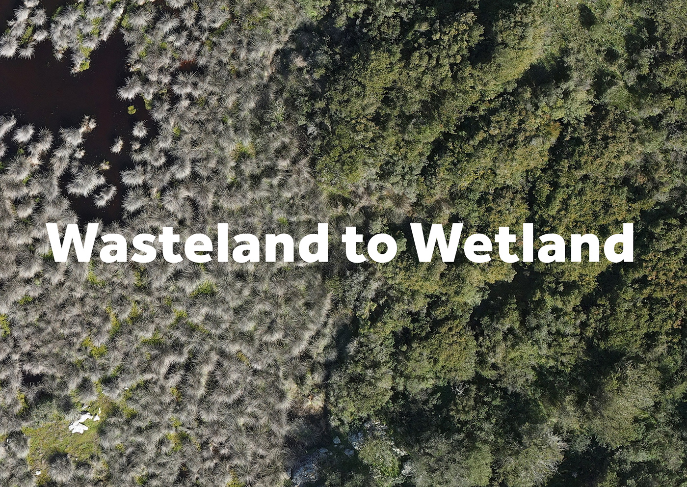
The wetland of Porto Liscia, nestled in the northern reaches of the island of Sardegna, stands as a captivating blend of land and water, spanning approximately 80 hectares. This enigmatic terrain, marked by brackish waters and a rich tapestry of deposited soil sediments, has long served as a vital frontier, its boundaries blurred amid the interplay of diverse ecosystems. Historically celebrated for its abundant fishing and harvesting opportunities, the wetland has undergone manifold transformations driven by economic and sanitary imperatives, all under the guise of utilitarianism.
Embarking on a multifaceted exploration, this thesis endeavors to unravel the essence of Porto Liscia's wetland through meticulous data analysis, exhaustive research, and innovative geomatics techniques. Situated amidst a nexus of geographical landmarks, including Culuccia Island to the north, the coastal expanse of Porto Liscia, and the meandering river to the east, the wetland boasts a mosaic of fishponds and swamps, each contributing to its ecological complexity.
Central to its identity is the distinctive vegetation, resilient halophytes such as Salicornia and Juncus, which thrive amidst the brackish waters, embodying the wetland's adaptive prowess. Yet, amid the verdant splendor, invasive species like Spartina Versicolor present formidable challenges, underscoring the delicate equilibrium within this dynamic ecosystem.
Beyond its ecological significance, Porto Liscia's wetland emerges as a beacon of biological productivity, its primary production eclipsing even the most fertile of landscapes. A haven for avian migrants traversing continents, the wetland beckons a diverse array of bird species, from ospreys to flamingos, offering a sanctuary amid their transcontinental journeys.
To address the wetland's challenges, the aim is to enhance understanding by employing historical analysis and modern technologies such as UAVs and mapping techniques. Venturing into the realm of geomatics, a meticulous survey unfolds, weaving together historical maps, aerial imagery, and cutting-edge technologies to craft a nuanced portrait of the wetland's evolution. From the ambitious engineering projects of the past, such as fishing canals and sea walls, to the contemporary efforts of digital mapping, historical orthophotos, cartography, and 3D modeling, each iteration bears witness to the intricate interplay of human intervention and natural forces.
Guided by a vision of harmonious coexistence, the thesis transitions from observation to action, proposing a non-invasive design intervention that honors the wetland's intrinsic resilience. Through the careful selection of intervention sites and the integration of indigenous materials and cultural motifs, a visitor's path emerges, offering a symbiotic blend of recreation and conservation. From perching stations for birds to submerged birdwatching enclosures, and native granite blocks to raised decking systems, each element is meticulously crafted to foster a deeper appreciation of the wetland's majesty while safeguarding its integrity by adapting to various seasonal changes and water levels, allowing for the possibility of a year-round experience and visitation.
In essence, the wetland of Porto Liscia stands as a testament to the intricate dance of nature and human endeavor, a living canvas where past, present, and future converge in a symphony of resilience and adaptation. Through diligent inquiry and thoughtful stewardship, this thesis seeks not only to illuminate the hidden depths of this enigmatic landscape but to inspire a new era of symbiosis and understanding.
SOFTWARE & EQUIPMENT:
. Geomatics: Metashape, QGIS, UAV: DJI Enterprise MATRICE RTK 300 with LiDAR, GNSS, & Ground Control Points
. Modeling: Rhinoceros, Grasshopper, AutoCAD
. Visualization: 3ds Max, V-ray, Photoshop, Illustrator
. Presentation: InDesign

Wetland of Porto Liscia - Sardegna Italy

Possibility of canoeing the wetland during high tide in which the sea waters rise for about 50cm

Cartography of the Wetland: After spending two months of manual vectorial retracing of the wetland, all the data is grouped together to form a 3D cartography of the wetland.

DSM Digital Surface Model: real z values generation
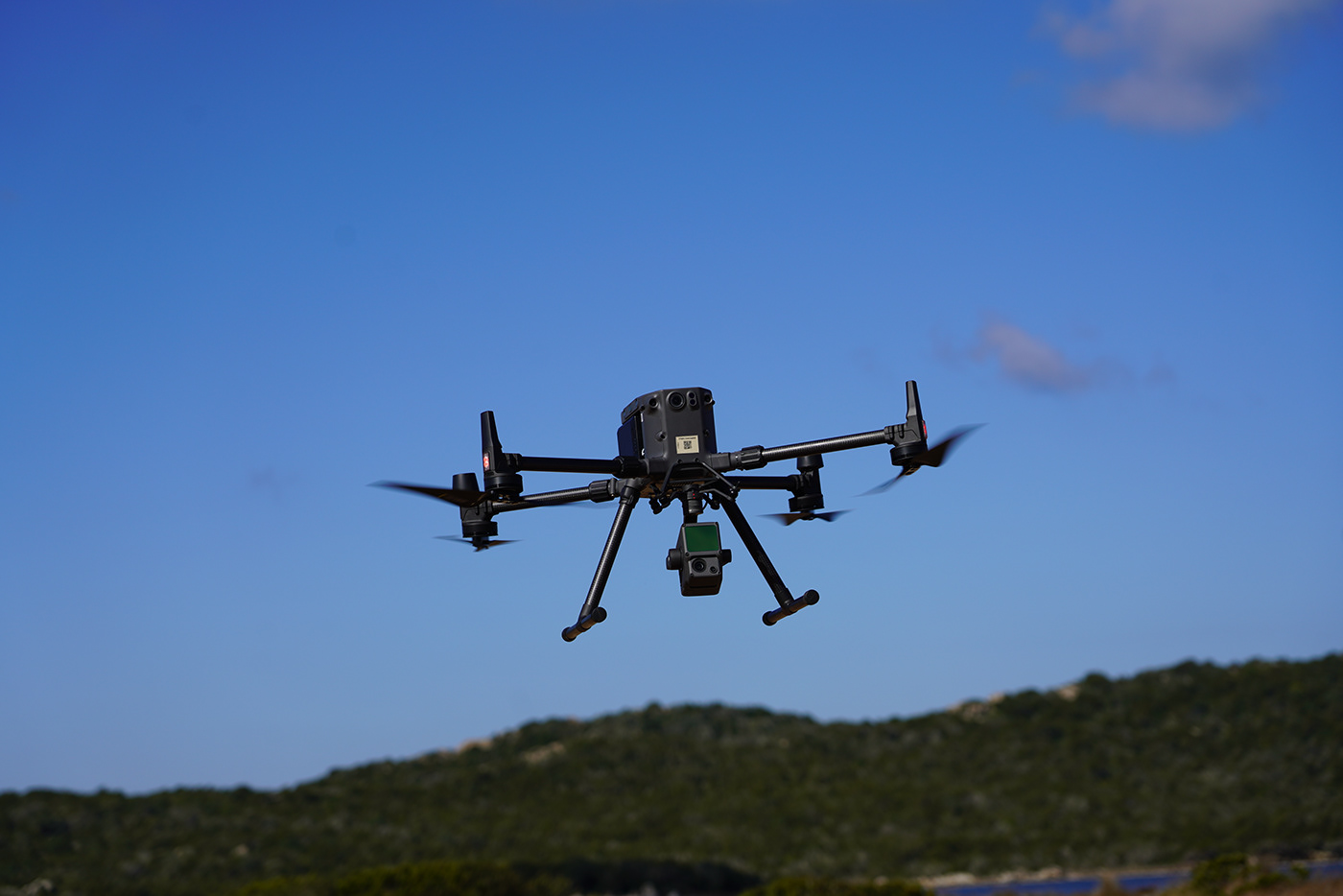
UAS Photogrammetry


3D Model of the Wetland - Metashape

Rectified Orthophoto in which distortion and perspective are eliminated, having a uniform scale of one value which is the real-world value allowing direct measuring on a realistically textured map.

General plan of the intervention: centrality among all main areas and basins of the wetland and vicinity to the existing roads
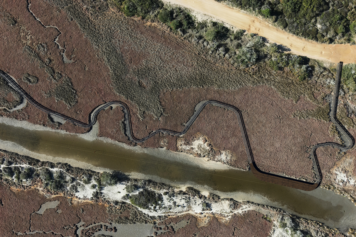
Path part I: Steel decking, and wooden platform as port for canoes

Path part II: Steel decking, and granite detached blocks

Path part III: Steel decking, granite blocks, and scientific research artificial ponds

Path part IV: Steel decking, and granite underground bird-watching unit

Path part V: Steel decking, wooden bench, and second port for canoes along the canal

Camouflaged design with scenic stops

Path’s natural integration and adaption to different seasonal changes


